Recommended Season: April to mid June, Late September to early December
Max Elevation: Approximately 5000 meters
Difficulty: Medium-Challenging
This is the classic Jomohlari Loop. We are tweaking it and adding an extra day to go up to Jomolhari Nye/Lhakhang. This can removed if you wish to and shorten the break by a day. The entire route involves 2 high passes (+4500 meters) and 3 nights at high camps (+4000 meters). A trek that is comparatively challenging, taking you to a maximum elevation of close to 5000 meters, Starting and finishing near Shana Zampa (Gunitsawa Village).
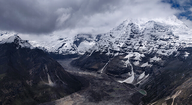
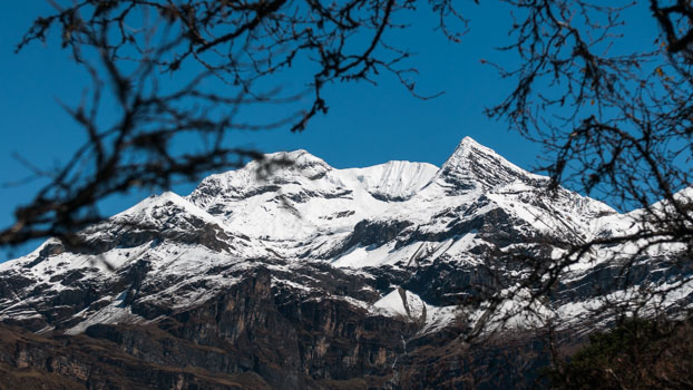
Apart from sharing the landscape with giants like Jomolhari, Jitchu Draké and Tserim Kang the trek also offers an excellent mixture of natural landscape, fauna and a cultural experience. Crossing Bhonte la pass (4900 meters) and sharing the space with highlanders is another highlight of this trek.
Note: The sighting of flora and fauna is seasonal.
ITINERARY
Day 1: Arrival
Arrive at Paro airport. Sightseeing around Paro
Day 2: Paro
ACCLIMATIZATION hike to Paro Taktshang (Tiger’s Nest). Walk around Paro town and prepare for the trek.
Day 3:
Trek Day 1: Shana Zampa to Thang Thangkha
Distance: Approximately 17 km about 8-9 hours. Campsite Altitude: Approximately 3600 meters.
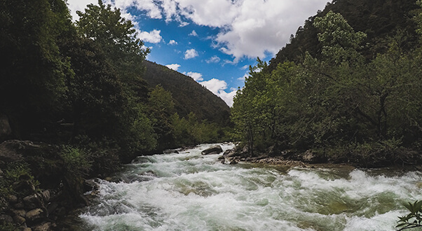
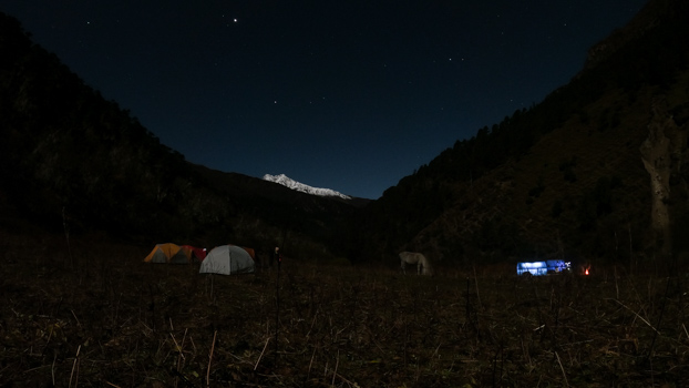
Early morning drive to the trailhead at Shana Zampa. The trail follows the Pa Chhu (Paro River) the entire day, ascending and descending through narrow valleys of pine, oak and spruce forests. After crossing the river multiple times, the final crossing is marked by a relatively long suspension bridge. Our campsite, Thang Thangkha, is another 20 minutes from here. The southwest summit of Jomolhari should be visible from the campsite if the weather permits.
Day 4:
Trek Day 2: Thang Thangkha to Jhomolhari Lhakhang and back
Distance: Approximately 17 km about 8-9 hours. Campsite Altitude: Approximately 3900 meters.
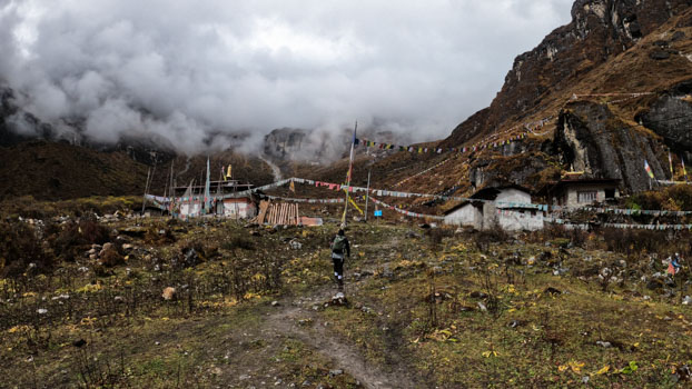
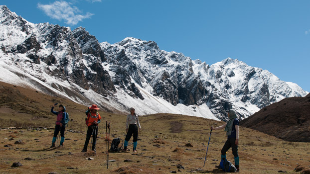
The trail continues up the valley, crossing an army outpost, which eventually widens into patches of alpine meadow and scanty growths of forest. From here, we leave the main trail and go off the beaten path. Starts off with a steep climb for about 45 minutes after which the trail flattens all the way to the Lhakhang, nestled in the mountains west of Jomolhari. Return along the same trail and camp by the stream that flows through the valley.
Day 5:
Trek Day 3: To Jangothang
Distance: Approximately 9 km about 4-5 hours. Campsite Altitude: 4000 meters.
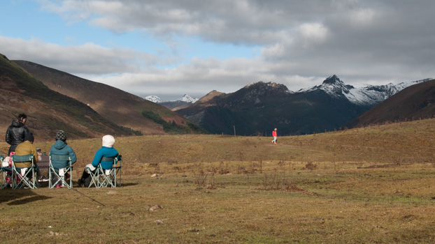
Cross the bridge that goes over the stream and continue on descending. The side trail eventually joins the main trail. Easy walking here on out till camp, crossing a few houses and chortens(stupas) along the way. Keep an eye out for groups of blue sheep grazing on the hill sides.
Day 6:
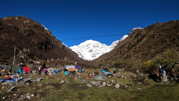
Trek Day 4: Rest Day
The rest day at Jangothang provides plenty of possibilities for short but demanding day hikes or just stretching your feet or catching up on sleep and rest.
There are several good short hiking in three directions. Jhumolhari and its subsidiary mountain chains lay directly west, Jichu Drake to the north and there are a number of unclimbed peaks to the east.
Day 7:
Trek Day 5: Jangothang to Soe Yaktsa
Distance: Approximately 16 km about 7-8 hours. Campsite Altitude: Approximately 3900 meters.
High Pass: Bhonte la (4900 meters)
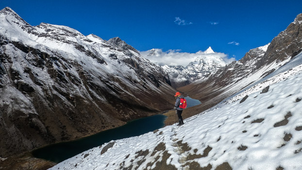
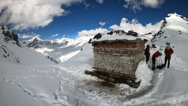
Cross the first bridge that goes over the stream that flows from the base of Jitchu Draké. Steep walking for about an hour and then flattens till Tshopu lakes. Keep an eye out for Himalayan Marmots on this stretch of the trail. The trail gradually climbs through pass the lakes all the way to Bhonte la, look back to get epic views of Jitchu Drake and Jomolhari II. After crossing Bhonte la the trail descends, some sections are steep and covered in loose rocks and gravels. Our campsite is by a river that flows through the Yaktsa region.
Day 8:
Trek Day 6: Soi Yaktsa to Thombu Shong
Distance: Approximately 11 km about 5-6 hours. Campsite Altitude: Approximately 4100 meters.
High Pass: Takhung La (4500 meters)
The trail today is surrounded stunning rock formations and scenery. After leaving camp the trailclimbs up 100m over a ridge and drops to another stream only to climb again over Takhung la pass. After crossing the pass we descend to Thombu Shong, where we will camp next to a yak herders camp.
Day 9:
Trek Day 7: Thombu Shong to Gunitsawa Village
Distance: Approximately 11 km about 6-7 hours.
Pass: Thombu la (4300 meters)
Transfer to Thimphu
Exit day!
Immediately after leaving camp the trail climbs for about an hour over Thombu La pass after which we will descend for one last time all the way to Gunitsawa where started 6 sleeps ago. Drive straight to Thimphu.
Day 10: Thimphu
A slow and relaxed day to recuperate from the trek.
Day 11: Thimphu
Sightseeing around Thimphu valley.
Day 12: Departure
Drive to Paro. Bid Bhutan farewell.